


The Met Office has issued an amber wind warning for parts of Wales, northern England and Scotland due to Storm Dave.
A rapidly deepening area of low pressure is expected to pass across northern parts of the UK on Saturday night, bringing the threat of widespread gales and local blizzards.
Travel disruption, power cuts and damage are possible.

Showers will follow on Easter Sunday, wintry over Scottish hills, before conditions improve on Easter Monday.
Multiple weather warnings
The Met Office has updated its weather warnings and issued a more severe amber wind warning.
Valid from 19:00 on Saturday to 03:00 on Sunday, winds in north-west Wales, northern England and southern Scotland are forecast to gust between 60–80mph (97–129km/h).
There is a greater risk of damage and disruption in these areas.
There is a risk of significant travel disruption during what is predicted to be the busiest Easter weekend in four years for drivers.
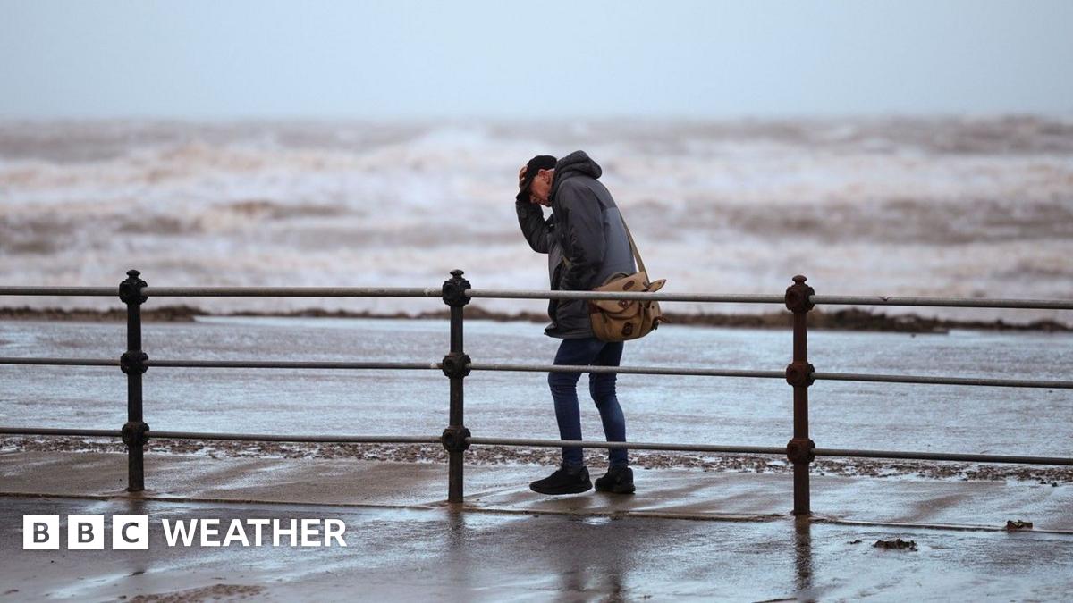
Flying debris is likely and could lead to injuries or danger to life, and there will probably be some damage to buildings, such as tiles blown from roofs.
There is a good chance that power cuts may occur, potentially affecting other services such as mobile phone coverage.
There is also a risk of injuries and danger to life from large waves and beach material being thrown onto coastal roads, seafronts and properties.
Latest yellow warnings from the Met Office for Storm Dave
Met Office yellow warnings cover a large area of Scotland, Northern Ireland, northern England, and parts of north and west Wales.
The warnings are valid at various times on Saturday afternoon, overnight and into Sunday.
Widespread gusts of 50-70mph (80-112km/h) are expected with the chance of higher gusts in exposed areas, especially around coasts.
In addition, north-west Scotland is also covered by a Met Office yellow warning for snow.
Here, snow will quickly become heavy on Saturday afternoon and evening before clearing during the early hours.
Around 5–10cm (2–4in) of snow is likely at low levels, with 20–30cm (8–12in) possible on ground above 200m (650ft).
Coupled with the strong winds, this will lead to blizzards, snowdrifts, and very poor visibility on the roads.
The centre of Storm Dave is expected to pass across the north of Scotland
Storm Dave is being propelled towards the UK by a powerful jet stream - the flow of winds high in the atmosphere that develops weather systems and guides them around the globe.
This has been supercharged by large temperature contrasts across the US and Canada in recent days.
Storm Dave is undergoing explosive cyclogenesis, in which the central pressure drops by more than 24 millibars in 24 hours. This is also known as a "weather bomb."
However, the storm is moving very quickly and is expected to be centred over Scandinavia by midday Sunday, with winds easing across northern parts of the UK.
Storm names 2025-26: How do storms like Dave get their names?
Easter Sunday will be a day of contrasts as the storm slowly loosens its grip.
Strong winds will continue to blow across Scotland, Northern Ireland and northern England, bringing a chilly feel and frequent showers.
Some of these will be wintry over hills and mountains, and perhaps even to low levels in northern Scotland at first.
Further south there will be sunshine and showers with the showers becoming fewer and further between during the afternoon. But here, strangely enough, it will be cooler than Saturday.
UV levels are expected to peak at moderate in the sunniest spots.
Temperatures on Easter Sunday will range from 7C (45F) in northern Scotland to 13C (55F) in south-east England
As winds continue to ease on Sunday night things will turn cold with a widespread slight frost.
However, after a chilly start to Monday temperatures will climb through the day, with southerly winds bringing afternoon highs of 10-15C (50-59F).
Most areas will be dry with patchy cloud and sunny spells, which is expected to bring high or very high pollen levels.
Check the Met Office pollen forecast for your area below. Levels range from L for Low to VH for Very High.
Tuesday currently looks set to turn even warmer with 20C (68F) looking possible in parts of England and Wales.
Temperatures in England and Wales could climb higher on Wednesday and it may be the warmest day of the year so far.
Most models show temperatures dropping a little later in the week as weather fronts move in from the Atlantic.
You can always keep up-to-date with the longer range prospects with our monthly outlook - and follow the hour-by-hour forecast for your area by checking the BBC Weather app.
Spectacular Pink Moon lights up UK night sky
Man dies in storm as Saharan dust shrouds Crete
Carol Kirkwood: Why the time is right for me to retire - and what's next


 The Guardian